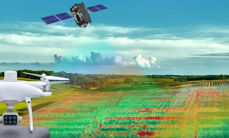
Agriculture Drones Make Way for Satellite Observation

The growth and technological development that the world is experiencing is unstoppable and, how could it be otherwise, this sector also benefits from it.
From satellite images or precision agriculture techniques, through application software in agriculture or drones, all of them contribute their grain of sand to make field management much more efficient, simple and sustainable.
On the one hand, satellite images are ideal for having an overview of the field, as well as being able to monitor large areas of crops. This type of monitoring is used not only by farmers, but also by insurers who want to check whether insurance claims are genuine.
However, some crop conditions are difficult to assess from afar, and that’s where agriculture drones come into play.
Its use allows monitoring very close to the plant, and is especially useful in fields of tens of hectares, where exploring the field on foot would take hours.
What can be done with them? Advantages and possibilities
For some time now, satellites and their satellite photos were considered the most advanced option to observe and/or map the field, although it was not 100% perfect. But drones are presented as a cost-effective and accurate alternative.
Before going into detail, let’s see a quick comparative list between the two:
- The range of a satellite is much greater than that of a drone, which in large places may even require several flights.
- The satellite images contain all the information in each of them, while the drone shots need to be put together like a mosaic.
- The satellite images are georeferenced, allowing the coordinates of the place in question to be known.
- Drones require an operator to handle them, while satellite images do not require anything special.
- Satellite data is stored in files that allow you to take a look at the conditions of an area in the past by comparing several images, while drones can only show the current state.
At first glance it may seem that the use of drones for agriculture is not justified, but nothing is further from the truth. However, there are a few things to keep in mind.
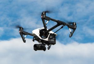
For example, there are different types of drones, with their particular characteristics.
Rotor drones are ideal for exploring small areas and their landing and take-off area is small; For their part, fixed-wing drones require a larger area to do so, but at the same time they can cover more area and have greater resistance to gusts of wind.
Once you have chosen the type of drone that best suits your particular needs, you should consider whether to hire third parties outside the operation or train people within the company to handle them; Whichever option you choose, you must be aware of the existing regulations, especially those related to security (for example, it is prohibited to fly near airports or military enclaves) and/or the privacy of other people.
Drones for agriculture also have an increasing integration in agricultural management systems, allowing to reduce the time of planning and data analysis, as well as exporting said data to other elements, such as fumigation equipment.
Drones capture high-quality images and are increasingly being used to map areas that are difficult to access or even dangerous for people. Although they are not able to collect samples as a human would, they do allow you to determine which specific areas of the field might need the presence of an explorer, instead of combing the field blindly.
When flying at low altitude, cloudy days are not a problem to capture data, unlike what sometimes happens with satellites; they are also capable of flying in adverse weather conditions that could otherwise take several days if done manually (humanely).
Direct rivals or complement of each other?
It seems pretty clear that the specific use of satellite imagery and drones for agriculture is different enough that they are rivals.
Thus, the use of satellite images is ideal when:
- An overview of the terrain is needed. A satellite is capable of obtaining images of huge tracts of land, which can be useful when not much detail is required.
- You want to collect large amounts of data in a short time. Different satellites and sensors allow data to be obtained from anywhere in the world and the fact of being able to compare the data collected with data from other years allows the creation of predictive analysis models to make better decisions.
For its part, the use of drones for agriculture is ideal when:
- A close vision of what we want to see is needed. Drones display and capture high-resolution images meters or even centimeters from the target location, helping to visualize exactly what is happening so you can make a better decision.
- To replace field walk scans. If our field does not have any flight restrictions, a single flight operator can cover dozens of hectares from a quiet and comfortable place, without any person having to walk the entire field; On the other hand, this is only possible if the weather conditions are good, since gusts of wind could prevent the correct flight of the device.
Therefore, it is possible to affirm that satellites and drones for agriculture can perfectly coexist together and complement each other.
A complete monitoring of the field involves using both systems, depending on whether the situation requires one or the other, and trying to integrate the data from both so that they work together. Although it is true that the short-term outlay can be a problem for some farmers, the fact of having the crops completely controlled, avoiding the loss of yield in them, makes this investment pay off in the long term.
Drones have arrived in agriculture and they are here to stay.
![Photo of Kiwi cuttings: [Grafting, Season, Rooting and Sowing]](https://www.complete-gardening.com/wp-content/uploads/2021/06/Esquejes-de-Kiwi-390x220.jpg)